Ruler
2GIS allows you to measure distances between objects (or points) on the map. Here is what to do:
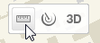
- Select the Ruler from the toolbar in the map window.
- Single-click to select the starting point for measuring the distance on the map and move to the desired location, clicking intermediate points. The Distance dialog window displays the measured distance and the approximate time required to walk this distance.
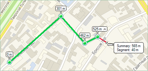 If the Show the nodes option is checked, the distance from the starting point to each node is displayed over each intermediate point. In the information window, next to the Ruler pointer,
  the length of the path and its last segment to the location of the cursor on the screen is displayed.
You can delete the last segment of the Ruler by means of one of the following ways:
- Press the Esc on the keyboard when the tool is enabled (the Distance window is open).
- Single-click at the cross sign of the last point added to the Ruler (the tool may be enabled or disabled).
- In the context menu, select Delete the last segment of the ruler.
Hide the measured path using the following ways:
- double-click anywhere on the map (when the Ruler tool is selected);
- click the Clear button in the Distance window; and
- in the context menu, select Clear the route of the ruler.